If you look closely at Oman’s map you will notice a peculiar detail. There is the mainland, and separated from it is its governate Musandam on a peninsula jutting into the Strait of Hormuz. Look more closely. You will see an exclave [called Madha] between the two that is surrounded by the UAE. Look at it even more closely. Within Madha is Nahwa, an enclave that belongs to the UAE.
Now you may well ask, how did this happen?
Somewhere around the late-1930s, the four rival sheikhs controlling the surrounding area asked Madha’s village elders who did they want to pledge their allegiance to? Madha chose the Sultanate of Oman, but the bit inside it called Nahwa chose the Arab Emirates. Based on their choice, the rather unusual border between the UAE and Oman was drawn out in 1969.
That is Oman for you.
The eclectic set of borders further transposes into an eclectic set of mountains, desert, and coastline, juxtaposed right next to each other. It is as if the gods asked them too, whose realm did they choose, and they all in unison said “Oman.”
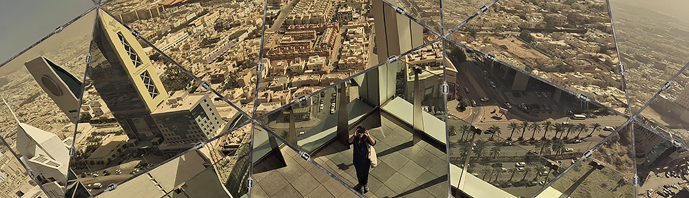
Described as a geologist’s paradise, the oldest continuously independent nation in the Arab World [since 1650] has held on to its authenticity well. Despite being a high-income country, there is no rivalry for high rises in the Sultanate of Oman, nor glitzy shows of oil wealth.
Come travel with me through my photo essay across northern Oman as I take you from Muscat to Fins Beach via the Bimmah Sinkhole and Wadi Tiwi, on to Ras Al-Hadd to see turtles and Sur to see dhows, camp under the stars in the Sharqiya Sands, stop by at a Bedouin market in Sinaw, have meals at traditional mud settlements, drive offroad to the top of Jebel Shams and then down Wadi Bani Awf, to be back in Muscat. And on the way, learn about this fascinating country and its warm, laid-back, friendly people. ❤
The journey begins.
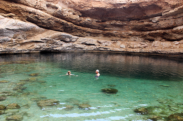
One of northern Oman’s grandest natural wonders is the Bimmah Sinkhole. The enormous 70-metre-wide depression is filled with turquoise-blue waters whose depth ranges from less than a metre to 20 metres in the deepest part.
Locals call it the Hawiyat Najm, meaning the ‘deep well of the falling star.’ They believe it is the handiwork of a meteorite. Scientists, on the other hand, claim it was formed by a collapsed surface layer because of dissolved underlying limestone. Either way, it deserves a climb down.
Somewhere on the way to Wadi Tiwi and Fins Beach. There was a dust storm in Iran the previous night, and the winds had bathed northern Oman in sand in the aftermath. I am told it is a common occurrence and it would clear up in a couple of days max. Oman’s raw landscape, usually painted in vivid colours, was just as beautiful in its muted misty avatar though. Wouldn’t you agree?
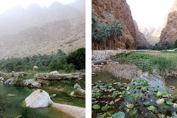
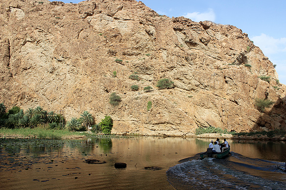
Two of Oman’s most famous wadis [valleys], and rightfully so, are Tiwi and Shab. Both win hands down when it comes to sheer beauty. While Tiwi is all about sparkling pools, limestone boulders, and tall grass hemmed in by high mountains, Shab’s expansive river covered in lotus plants leads to emerald pools and a secret waterfall.
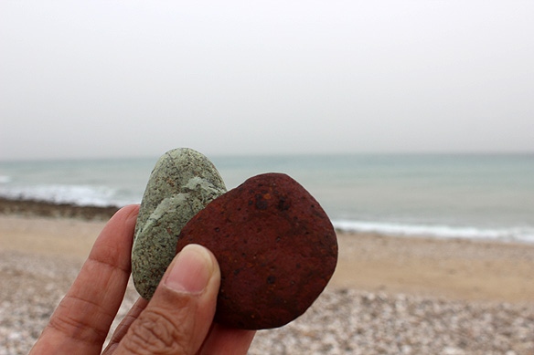
Fins pebbly beach is not all bland and grey. Hidden away are the odd-one-outs—deep-red and sea-green baubles of weathered smooth stone!
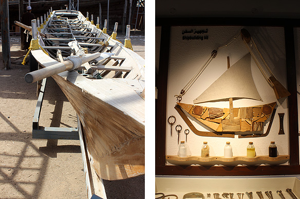
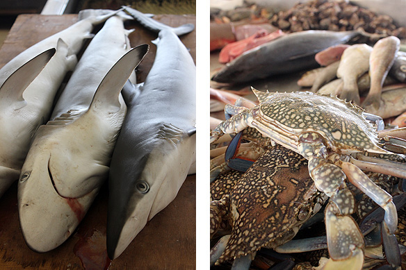
With a couple of thousand kilometres of coastline, it is no surprise that ship-building and sea-food have historically been a part of the Sultanate’s warp and woof. One city, nonetheless, has always stood head and shoulders above the rest when it comes to this side of Oman. And that is Sur.
Here, Oman’s dhows continue to be made as they have been done for centuries, with a museum thrown in to illustrate the finer nuances of this Omani craft. You will soon notice Oman’s fishermen are from Bangladesh and the dhow-builders are from Kerala in India. Of Oman’s 5.5 million population, 42 percent are expatriates mainly from the Indian subcontinent.

Sure enough, the weather cleared the next morning. The above sleepy fishing village in Sur with big whitewashed merchant houses, moored wooden dhows, watch-towers perched on rocky outcrops, and the newish [1996] lighthouse is called Al-Ayjah. Once upon a time Sur was a stronghold of rebellious sheikhs. Today, it serves awesome lunches.
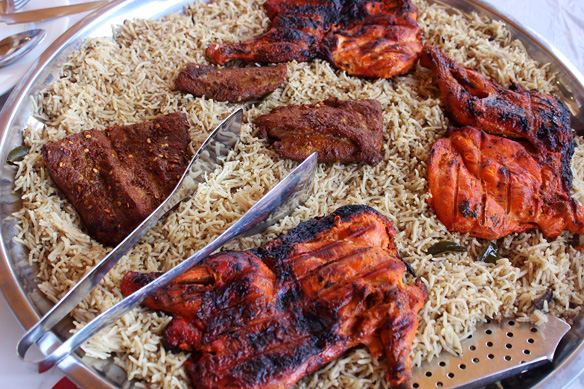
The lunch: Kabsa with chicken and fish.
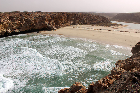
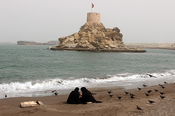
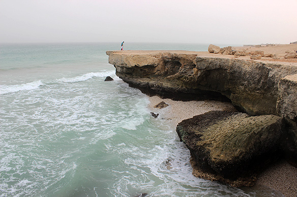
Oman’s rugged coastline, from the Arabian Sea and Indian Ocean in the south-east to the Sea of Oman in the north, is 2,092 kilometres long. Along the way, it breaks into iridescent beaches, battered cliffs, and secluded powdery coves.
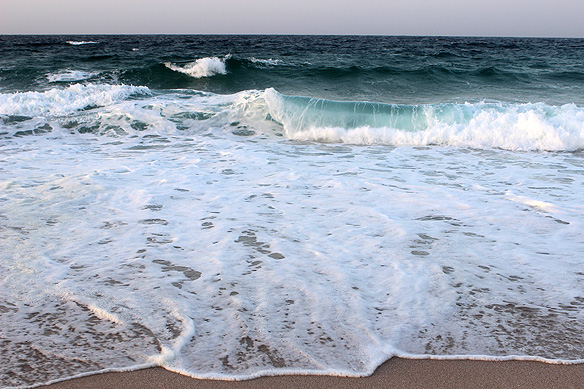
These crashing waves around Ras Al-Hadd are home to some 20,000 endangered Green Turtles including the Olive Ridley Turtle, Loggerhead Turtle, and the Hawksbill Turtle. Come night-time, they crawl ashore to dig pits, lay about a hundred eggs each, and then cover them with sand before going back to the sea. The best place to view this miracle of nature is at the Ras Al-Jinz Turtle Reserve.
Yes, I was lucky I got to see it all. No, I did not take pictures because I did not want to intrude in her space.
What was equally beautiful, for me, was witnessing another pregnant turtle’s decision to go back into the water instead. Huge and hefty, she dragged herself a few inches at a time only to collapse out of exhaustion. But she did not give up. She kept trying till she got to the edge. A wave reached out to her. She waited to be picked up. It fell short. She heaved herself a few more inches further into the sea and waited again. This time the wave picked her up, flung her high up in the air, and then receded with her in its folds under the dark star-lit sky.
I could almost feel her relief and joy. She was back home again.
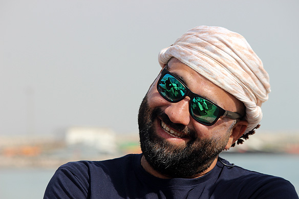
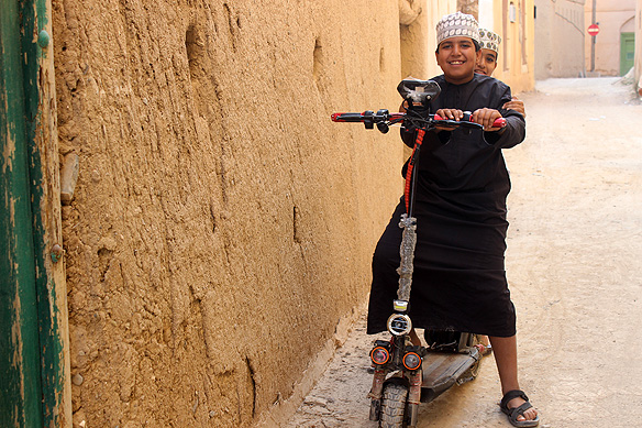
Meet Jabir Al-Balushi, my driver-guide who by the end of my eight days traversing northern Oman, I would fondly call “My brother from another mother.” Jabir is originally from Baluchistan.
Omanis are not a homogenous bunch. Though most are Arabs, the country’s sea-faring history and maritime empire, which included Gwadar in Baluchistan [part of present-day Pakistan] and Zanzibar on the Swahili Coast, has led to an ethnic mix that is intrinsically Omani. Gwadar was a colony of the Sultanate from 1797 to 1958. Baluchis [or Balushis as they are called here] comprise 20 percent of Omanis.
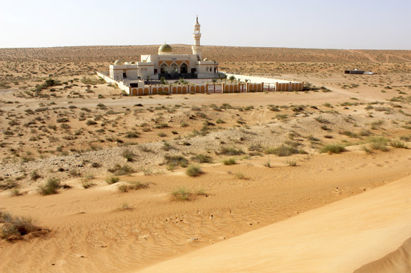
There are over 16,000 registered mosques in Oman. These are not paltry-sized, hole-in-the-wall versions, but grand in the literal sense with soaring minarets and over-sized domes.
Would the Wahiba Sands [recently renamed Sharqiya Sands] be any different? This modern mosque was specifically built, bang in the middle of the 12,500 sq. kms of sand dunes, to provide the Bedu [Bedouins], who call this part of the world their home, a place for Friday worship.
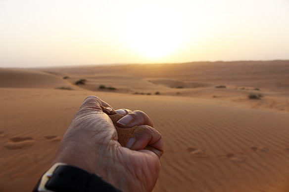
Life lessons at the Sharqiya Sands. When I hold on tight, it only hurts my own hands …
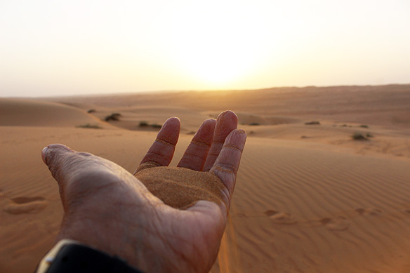
… And when I let it go, I set myself free. For sand never clings.
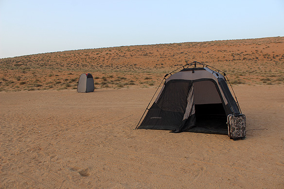
My tent in the middle of nowhere with my little floral suitcase by the “door” and the washroom behind me. Middle of nowhere, but definitely not alone. Sharqiya Sands is home to over 200 species of animals, 150 species of native plants, and the Bedu.
Sharqiya’s earlier name Wahiba came from the Al-Wahiba Bedouins, a nomadic Arab tribe predominant in the area.
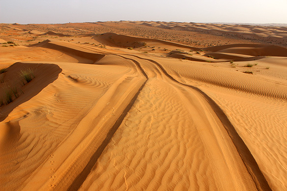
Leave only tire marks [as in this case] and take only memories. 🙂
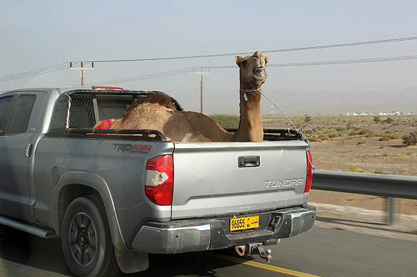
I think Mr/ Ms Camel was here smiling for the camera.
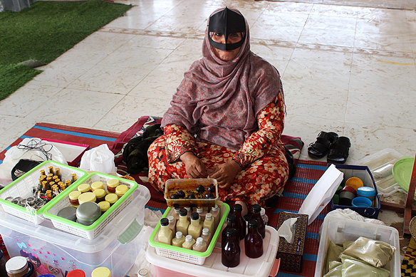
Bedouin woman selling herbal toiletries at the women’s market in Souq Sinaw, a marketplace where Bedouins from Sharqiya Sands sell their livestock and with the monies earned, shop for goodies.
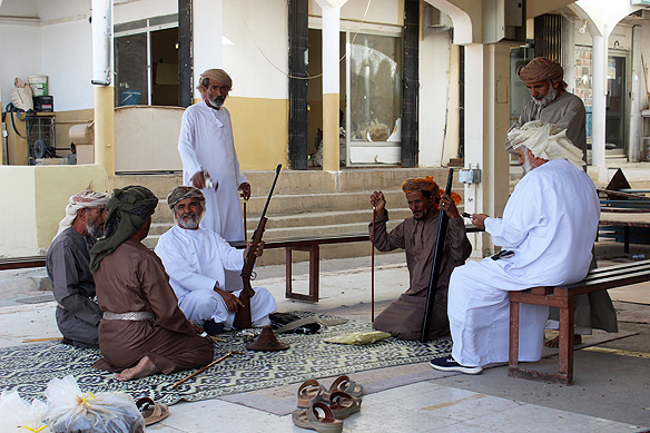
I also chanced upon these group of men haggling over firearms and khanjars [daggers] at Souq Sinaw. The weapons form part of ceremonial pomp and show at weddings.
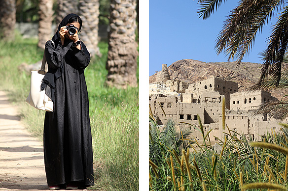
From one camera-happy-photographer to another in Birkat Al-Mouz, one of Oman’s most famous oasis towns swathed in date palm trees.
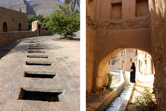
Harat Al-Siybani in Birkat Al-Mouz is an evocative historical settlement dating back to the 17th Century and inhabited till the early-21st Century. It contains around 50 abandoned mud-houses and three entrances, with falaj channels gushing crystal-clear water through it.
Falaj [plural Aflaj] are a traditional water channel system for irrigation and domestic use developed in Oman 2,000 years ago. Five Omani Aflaj, representative of 3,000 still in use and providing 30 to 50 percent of the country’s water requirements, are inscribed in the UNESCO world heritage list. Falaj Khatmein in Birkat Al-Mouz is one of the five.
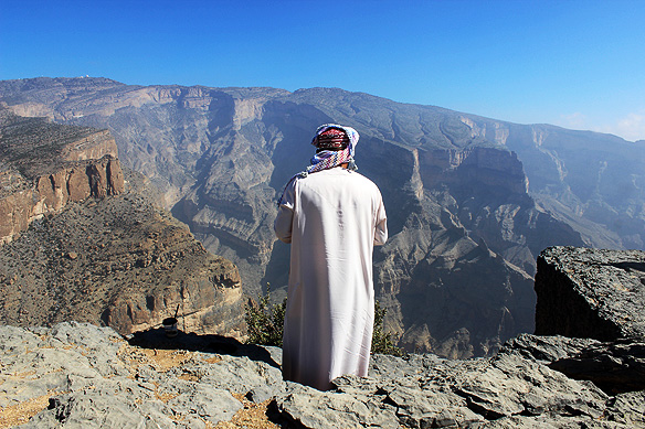
Atop Jebel Shams aka ‘Mountain of Sun’ [3,009 metres], Oman’s highest mountain in the Jebel Akhdar [Green Mountains] range. Below it is the Arabian Peninsula’s very own Grand Canyon: Al-Nakhur.
What makes these mountains doubly interesting is their geology. They belong to the Neo Tethys Ocean basin which after being submerged for millions of years under the prehistoric ocean, later compressed and pushed up, replete with marine fossils and sedimentary minerals in the carbonate outcrops.
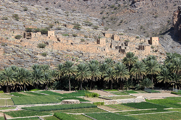
Right up-to a few decades ago, the mud-brick settlements in the foothills of the Jebel Akhdar mountains bustled with life; its residents engaged in subsistence farming. Though the dwellings, occupied since the 17th Century, are now abandoned and in ruins, the farms continue to thrive unabated, irrigated by Oman’s aflaj.
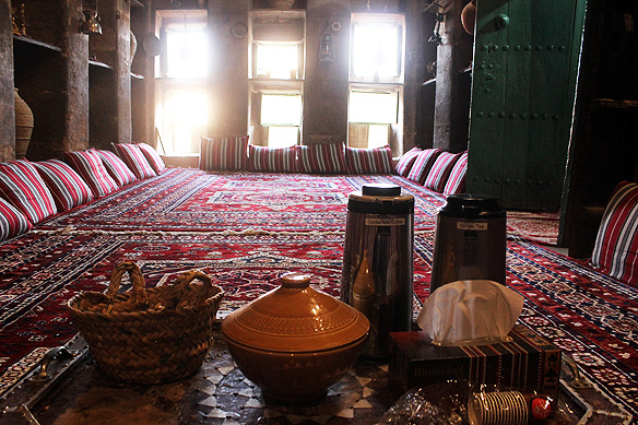
One such is the Al-Hamra settlement, which has decided to conserve its 400-year-old crumbling past. Snuggled amongst the collapsed multi-storey mud-houses is Bait Al-Safah [1655], a quirky living museum with buffet meals, culinary arts demonstrations, a family tree, and coffee and dates in the UNESCO-listed majlis [meeting room for visitors].
For a few hours, you too can step back in time and to another world which is fast disappearing.
New friends in Al-Hamra. And it is time to go back to Muscat.
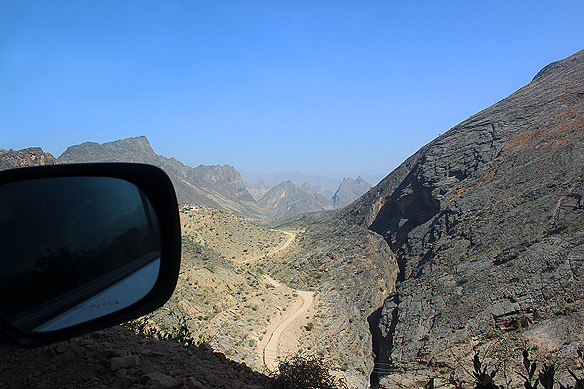
The reason I travel. Craggy peaks and deep ravines line the dusty, boulder-strewn offroad back to Muscat. It slices through Wadi Bani Awf with some of Oman’s most dramatic scenery for company. That is Snake Canyon to my right.
If you have been wondering where are Muscat and Nizwa, Oman’s two glorious capital cities, on this exhilarating ride across Oman’s northern terrain, stay tuned. Because they are up next on this blog.
– – –
[This blog post is part of a series from my 12-day travels across Oman in December, 2024. To read more posts in my Oman series, click here.]

Excellent!
LikeLike
Thank you! Oman is one of the most laid-back, easy-going, and yet stunningly lovely countries I have travelled to.
LikeLike
Now, I loved this! Back in the 1980’s I lived and worked in Oman for three years and have many photos virtually identical to many of yours. I haven’t been back since because I know it has changed a lot, and I don’t want to ruin my memories.
LikeLiked by 1 person
Wow and thank you. I understand not wanting to ruin memories. Would love to see what it was like back then. Have you written about it?
LikeLiked by 1 person
I put this post up, nine years ago: https://mickcanning.co/2016/02/19/oman-1/ I always meant to put up another, but never got around to it. Perhaps I ought to.
LikeLiked by 1 person
Thank you! Am going to give it a read this evening. Please do put up the second one too, if you can. It would be such a treasure.
LikeLiked by 1 person
I guess I’d better!
LikeLiked by 1 person
I could not resist. Had a peek at it! What a fabulous post. Yes, Oman has changed a lot. But thankfully, its mountains, desert and coast have not. They are still breathtakingly beautiful. Btw, it was nice to read about your affinity for the desert. I love the desert too, and often feel I was perhaps a Bedouin in some previous lifetime. 🙂
LikeLiked by 1 person
Thanks, Rama. Yes, I really enjoyed the desert. I think one reason must be that it is still largely unspoiled.
LikeLike
Beautiful post. The desert is extremely beautiful. Your commentary on it and the picture of the tent evoke travel lust. The turtle description also a picture painted.
LikeLiked by 1 person
Thank you! Oman was beautiful. Travel teaches many life lessons at the most unexpected moments. 🙂
LikeLike
A fantastic range of awesome natural phenomena with dwellings so well integrated and not one blingy skyscraper in sight – a rare treat
LikeLiked by 4 people
Oman is incredibly beautiful and so different from its neighbours. The neighbours are pretty cool too, but there is something to be said about the raw beauty of nature and living in harmony with it.
LikeLike
Pingback: travel diaries: a tale of two capitals—nizwa and muscat | rama toshi arya's blog