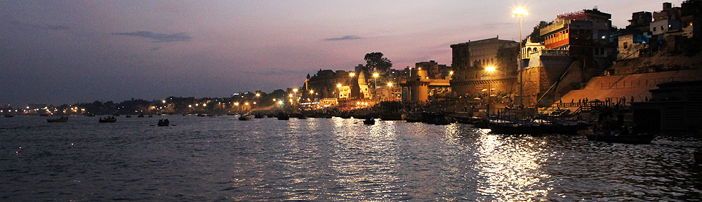
Welcome to my series on island-hopping in the Indian Ocean. Through 72-hour visual itineraries I hope to take the traveller in you under the islands’ skin. So, why this theme? I asked myself the same question. I live in Goa at walking distance from the beach. And a beach is a beach?
Wrong. 🙂 Every beach is different. And there is a whole world in an island, beyond its beaches. Or so I believe.
I am starting the series with Mauritius and Seychelles which I visited last month, and will be adding to the collection as I travel to more. In August, the temperature and humidity are mild in this corner of the world, and the waters very choppy. Compared to December when the reverse takes place, I figured it was easier for me to handle an odyssey.
A tiny pear-shaped dot in the Indian Ocean, 805 kilometres east of Madagascar, Mauritius owes its existence to volcanic activity eight million years ago. Okay, not exactly tiny. Mauritius spans 1,865 sq. kilometres.
The country Republic of Mauritius comprises four main groups of islands: Mauritius [the largest], Rodrigues, St. Brandon, and Agalega. Distances between the four range from 430 to 1,100 kilometres. When one mentions Mauritius, including this blog post, it usually means Mauritius island.
Though Mauritius first showed up in the early-15th Century on Arab maps when they were documenting their sea-trading routes, its first ‘settlers’ were the Portuguese a hundred years later. The latter used it as a pit stop on the long sea voyages between the Cape of Good Hope and India, and were followed by the Dutch [1598 – 1710] who gave the island its name, French [1715 – 1810], and British [1810 – 1968].
None of them came alone. They brought with them cattle, pigs, monkeys, Java deer, rats and dogs, and disease. All four also did one common thing. They emptied the island of its ebony forests and drove its fauna, such as the flightless Dodo and various other endemic bird species, to extinction.
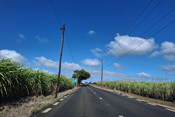
Soon the island was bare, and its natural lush vegetation replaced with lucrative sugarcane plantations instead. But because Mauritius had no indigenous population whatsoever, slaves were brought in from Madagascar and East Africa. Once the slave trade was abolished during British rule in 1835, indentured labourers were brought in from India, another British colony. Chinese traders joined the immigrants.
Mauritians are the by-product of this history and economy. Of slave trade and indentured labour and 370 years of colonial rule.
Walk down its capital Port Louis and the entire human ethnic spectrum meets you in the eye. Indo-Mauritians, Africans, Creoles, Sino-Mauritians, and Caucasians. Both monoracial and biracial. They work and live together, in a world of peaceful coexistence.
Most people come to Mauritius, enjoy its spectacular beaches and leave. Here’s the rest of the island’s story. ❤
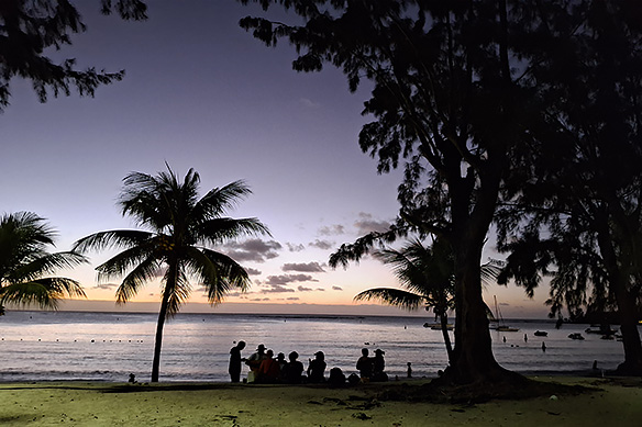
[Title image: A group of local musicians singing at Pereybere Beach. In-text image: Sugarcane plantations on the main road to the ‘north.’]
DAY 1: EXPLORE THE CHARMS OF PORT LOUIS AND NORTH MAURITIUS
Founded in 1735 by its French Governor-General Bertrand Francois Mahe de La Bourdonnais, Port Louis has come a long way from the small settlement it once was on the northwest coast. 141,000 of Mauritius’ 1.26 million population now call it home. An additional 200,000 to 300,000 enter the city daily for work or leisure. Crowded, yes. Noisy and chaotic, yes. Worth a visit, a big yes.
Port Louis has its fair share of pockets of tranquillity and deep historical significance, including the UNESCO World Heritage Site Aapravasi Ghat. There is also the opportunity for some close encounters with the now lost Dodo, and tastings of culinary delights that reflect the island’s eclectic ethnic mix. Close by are the Pamplemousses Botanic Garden, renamed Sir Seewoosagur Ramgoolam Botanic Garden and the Chateau de Labourdonnais, a rum distillery. Where there is colonial sugarcane plantations, there is usually rum.
Start the day with Port Louis, then explore the island’s north, and end at the northern beaches. If it is too much, you could split the stops over two days.
Stop 1: Port Louis, capital city of Mauritius
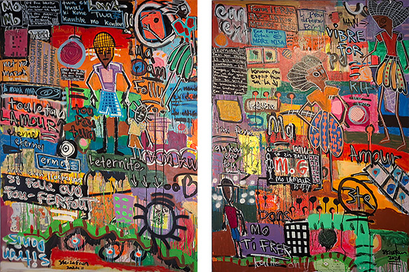
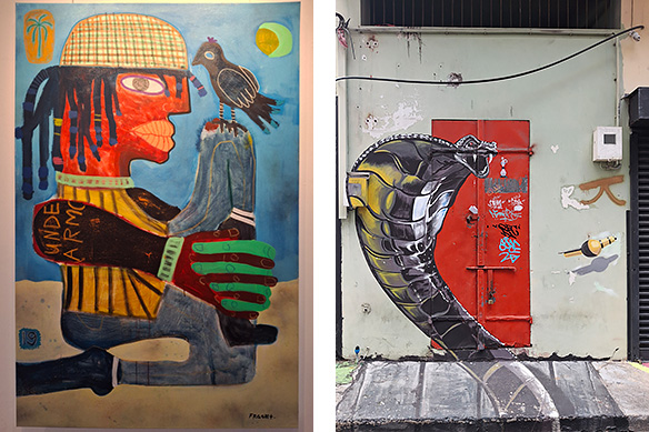
What’s a city without its art! The Caudan Arts Centre runs fabulous exhibitions on Contemporary Mauritian Art. Meanwhile, as part of an urban-renewal project in Chinatown, there is pretty cool wall art. Top: Pou Tw’Ama by Skizofan; Above left: Man Talk by Gael Froget, Above right: Manga art in Chinatown.
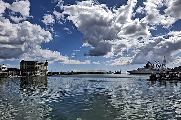
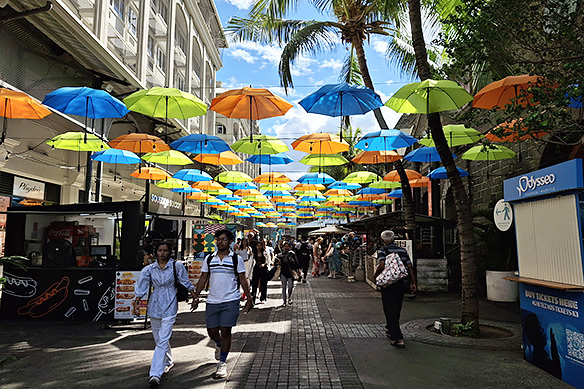
Caudan Arts Centre is housed in the swanky pedestrianised Le Caudan Waterfront along the city’s working harbour. Popular with both locals and tourists, it overflows with restaurants, bars, and cafes.
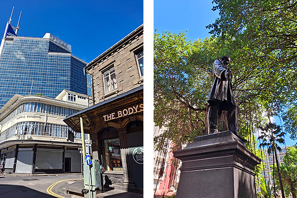
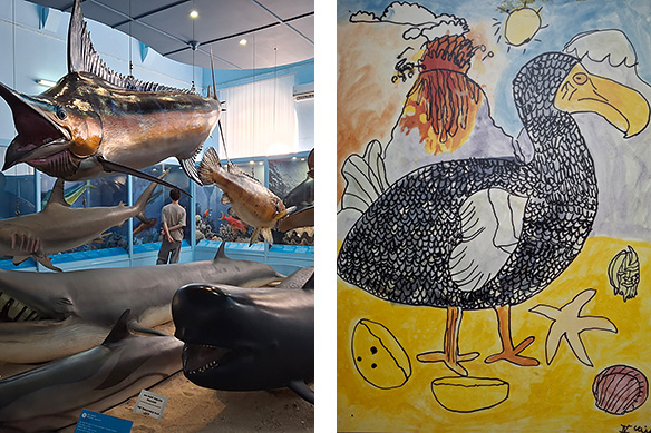
Old Port Louis, lined with British colonial-era government buildings, is the heart of the capital. Here, the past two hundred years jostle for space, along with memories of pre-British rule Mauritius. Not to be missed is the Natural History Museum where Mauritius’ extinct and endangered fauna find a voice. Next to it is the Company Gardens filled with towering banyan trees, fruit bats, and statues of famous characters from Mauritian history. The French East India Company headquarters once stood at this same spot.
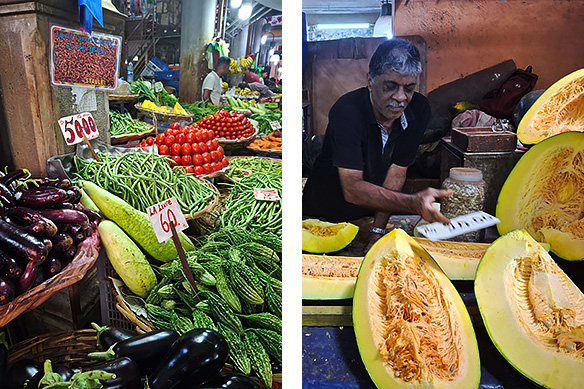
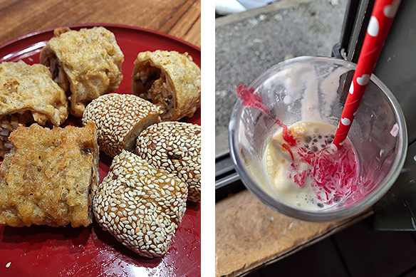
To best grasp the country’s vast range of ethnicities, dig into its street food. Above: Chinese treats at Mister Chu [established in 1942], Chinatown, and Special Alouda Sorbet at Chez Mevine, Port Louis Market.
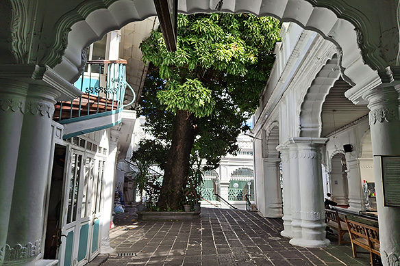
Jummah Masjid, built in 1853, combines Indian, Creole, and Islamic architectural features. Known initially as the Mosque of the Arabs, it houses an almond tree predating the mosque and the shrine of a saint from Kutch in India.
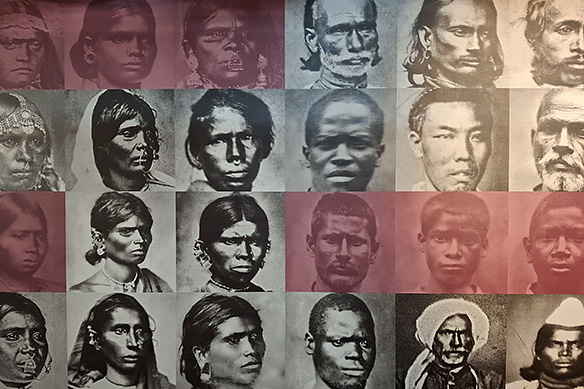
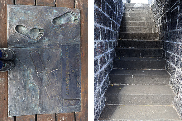
Stop 2: In 1834, the first batch of indentured labourers from India arrived at the Aapravasi Ghat to work on the sugar estates. They were part of an ‘experiment’ to see how indentured labour could replace the slave trade. Within a decade, the British colonial rulers transferred half a million more from across the Indian subcontinent, turning Mauritius into its most successful sugar-producing colony. Living conditions for these labourers were no different than that of the slave trade it sought to replace.
Aapravasi means ‘immigration’ and Ghat means ‘steps leading down to the water.’ Both are Hindi words. The site was listed as a UNESCO World Heritage Site in 2006 to mark the place where ‘modern indentured labour diaspora’ began.
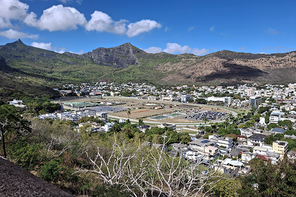
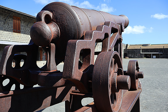
Stop 3: La Citadelle or Fort Adelaide wins hands down for the best views of Port Louis encircled by the Moka Mountains and Champs de Mars, the oldest race course in the southern hemisphere [1812]. A British colonial remnant, the abandoned basalt lookout post, replete with canons, dates back to 1832.
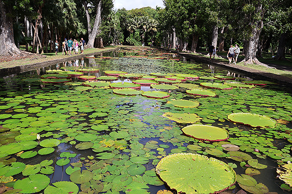
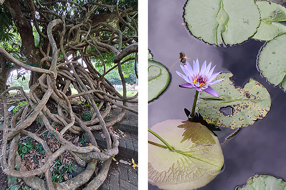
Stop 4: Southern hemisphere’s oldest botanic garden, meanwhile, is the handiwork of a French administrative official who decided to collect vegetables, fruits, flowers, and spices from around the world and plant them in Mauritius in 1767. Over the centuries Pierre Poivre’s garden has changed somewhat [there are no vegetables any more] and the name changed from Pamplemousses to honour the country’s first prime minister.
Top attractions within include prized aquatic plants such as the giant water lily [Victoria amazonica], 80 different species of palm, and endangered endemic flora. Pierre Poivre makes an appearance in Seychelles too as you will see in next week’s post.
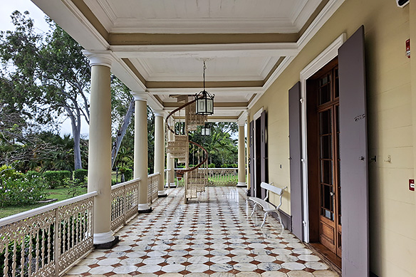
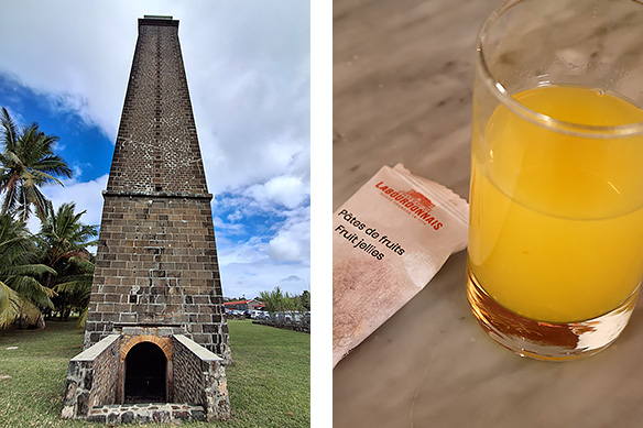
Stop 5: After the sugarcane is crushed and its juice turned into sugar, the leftover molasses is fermented and distilled to make rum—an alcoholic beverage typically produced in every sugarcane plantation island. In Mauritius, the tradition is carried on at Domaine de Labourdonnais, an estate founded in 1774.
When in Mauritius, do as Mauritians do. Which translates to taste some rum. If it is not exactly your kind of drink, don’t fret. You can mix it with fruit juice or chew on fruit jellies after each sip or do both.
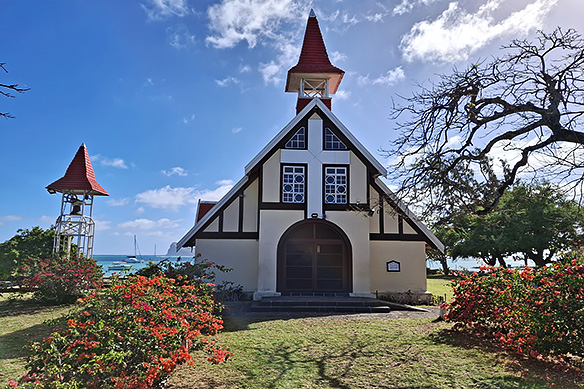
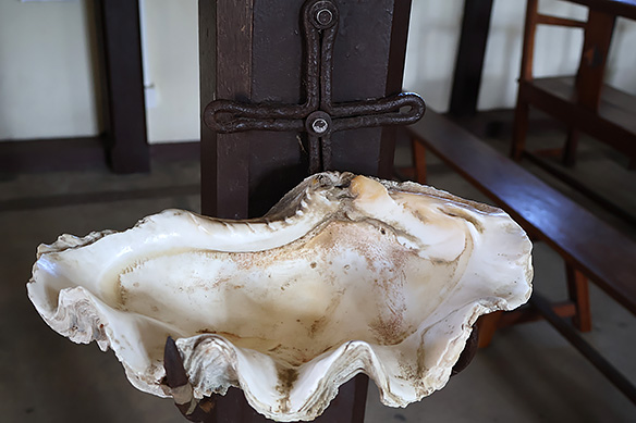
Stop 6: Red-roofed Cap Malheureux Church, North Mauritius’ most recognizable landmark, is a Roman Catholic church consecrated in 1938. Look out for the holy water basin made from a giant clam shell inside.
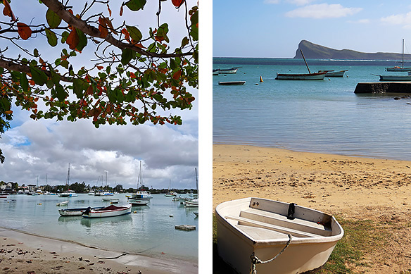
Stop 7: Every beach in Mauritius is different, even when they sit next to each other. Left: Touristy Grand Baie with its catamarans; Right: Northernmost point of Mauritius with Coin de Mire island in the background. In 1810, British colonial forces anchored at Coin de Mire island, marched into Port Louis, and took control of Mauritius for the next 158 years.
DAY 2: TAKE A 5-ISLAND SPEEDBOAT TRIP ALONG MAURITIUS’ EAST COAST
Be warned, this is not for the faint-hearted or those who suffer from motion sickness. But if you have innards of steel, visiting four small islands off the east coast of Mauritius on a speedboat in August [the 5th island is Mauritius itself] is an adrenaline-pumping experience which promises to plaster a goofy smile on your face.
December sees calmer seas, but the weather is hot and humid. In August, it is the reverse—dry mild weather with powerful currents that throw the waves helter-skelter. Especially once one leaves the safety net of the coral reefs and enters the deep seas. The speedboats then get tossed around and landings at the islands are invariably a wade through thigh-high crystal clear waters. Just don’t step over the coral. They are brutal. Seaweeds are a notch safer. Sand is the best bet, except that it never lies still.
On a side note, the captain may choose to change the exact order of the stops below based on Mauritius’ infamously fickle tropical island weather.
PS. I don’t have pictures of the churning Indian Ocean mid-sea as I was too busy holding on to dear life to the bow rails. 😀
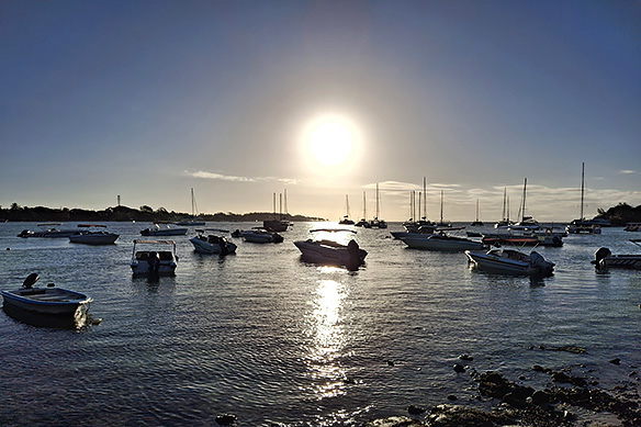
Sunrise at Trou d’Eau Douce. Speedboats to explore the islands off Mauritius’ east coast leave from its jetty.
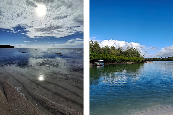
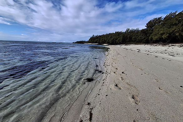
Stop 1: Mauritius’ most photographed island, Isle aux Cerfs is privately owned and houses the Isle aux Cerfs Golf Club along with water activities on offer and a string of restaurants. Walk away from the commercial trappings in the early morning, and it reverts to its pristine self.
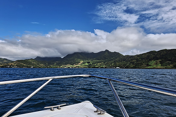
Stop 2: Looking for dolphins off the east coast of Mauritius. Yup, one sees them aplenty frolicking in these waves.
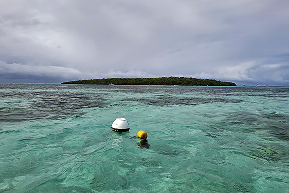
Stop 3: This little coralline limestone island surrounded by emerald waters in Mahebourg Bay is Ile aux Aigrettes Nature Reserve. Tortoises, a prolific birdlife, and the last vestiges of Mauritius’ indigenous ebony forests on the outcrop recreate the Mauritius that once was. Visitors can dock, but not enter. Entry is only by guided tours through the Mauritian Wildlife Foundation.
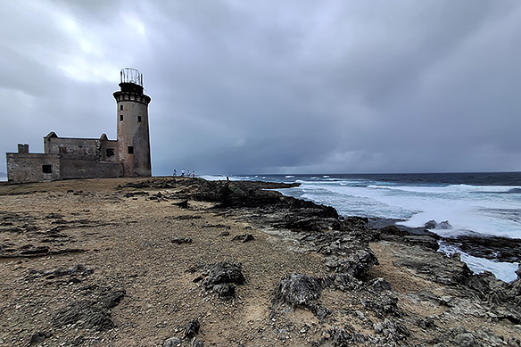
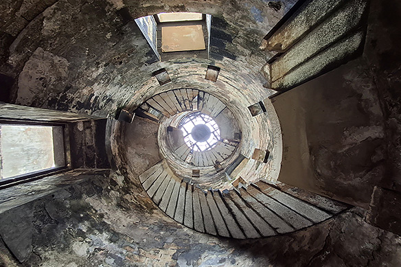
Stop 4: The abandoned gatekeeper. Built in 1864 during British colonial rule, Isle aux Fouqets Lighthouse stands guard at the only opening in the coral reefs through which deep ships can pass. On one side of the island is the sheltered lagoon. On the other, the deep treacherous sea. Next to the island is Ile de la Passe, site of the 1810 Battle of Grand Port between the French and the British.
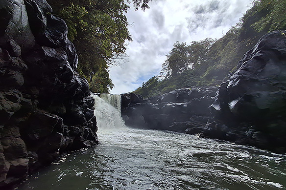
Stop 5: Mauritius’ longest river as it crashes over massive basalt blocks to form the GRSE Waterfall before it flows into the Indian Ocean. Wondering about the name? GRSE stands for Grand River South East.
DAY 3: DISCOVER THE UNTAMED BEAUTY OF SOUTH MAURITIUS
Curepipe, located in the middle of the island is the oldest and highest of Mauritius’ plateau towns, and the southern-most frontier of its string of commercial settlements. The unusual name stems from the soldiers and travellers who would stop here to clean or ‘cure’ their pipes in the 18th Century.
Past Curepipe, the landscape gives way to craggy peaks, luxuriant forests, gushing rivers and waterfalls with a handful of geological, natural, and spiritual wonders thrown into the mix. Comprising a series of national parks, this is the Mauritius that once was, before it was stripped to the bone and replaced with sugarcane plantations.
The best way to see this portion of the island is on a ‘private tour,’ which in essence is a private taxi service with a fixed set of stops, including a lunch stop.
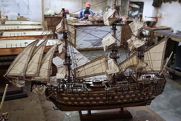
Stop 1: Ever wanted to see how ship models are made by hand? In recognition of Mauritius’ role in the Indian Ocean trade routes, Le Port Ship Model Factory and Showroom in Curepipe offers a crash course in the meticulous process behind replicas of history’s most famous boats. There’s no pressure to buy.
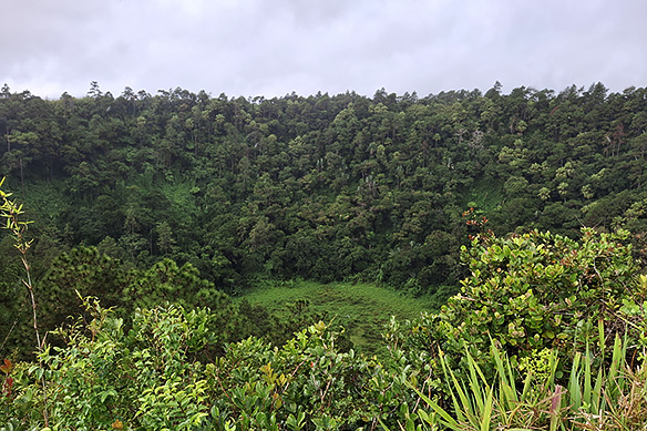
Stop 2: Bang in the middle of Curepipe is Trou aux Cerfs, a 350-metre-diametre dormant volcano covered in thick vegetation. A pedestrian-only road on the rim offers tantalising views of the crater and the surrounding mountains.
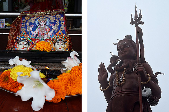
Stop 3: Grand Bassin aka Ganga Talao, a sacred crater lake, is to Mauritian Hindus what Haridwar is to Indian Hindus. On Maha Shivratri, the island’s entire Hindu populace [47.9 percent of the total population] lands here to pray to Shiva. Every Kanwar Yatra, in the monsoon months [sawan] preceding Maha Shivratri, pilgrims walk barefoot to its waters, which they believe has the same sanctity as the Ganges, to collect it for their village shrines.
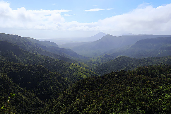
Stop 4: Spread over 16,250 acres, the dense forests of the Black River Gorges National Park have hid many an escaped slave in the island’s past. On a clear day, one can see four peaks and the Indian Ocean from its viewpoint. On an overcast drizzle-prone day, which is most of the time, the majestic vista shrouded in mist still impresses.
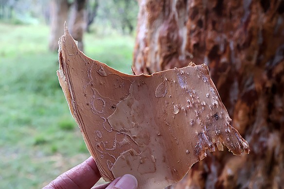
Bark of a paper tree at the Black River Gorges National Park.
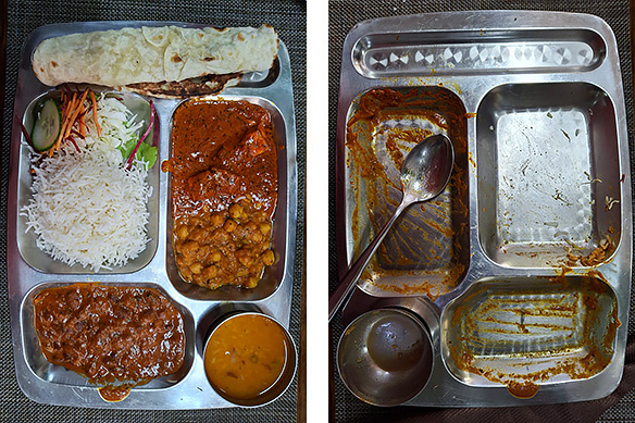
Stop 5: Lunch Before and After. Vegetarian thali at Chez Ruben Restaurant in Chamarel.
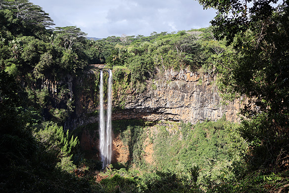
Stop 6: When Charles de Chazal de Chamarel set off in 1791 to clear the forests in his father’s 156-acre property in order to plant sugarcane, cotton, coffee, and indigo, little did he know he would stumble upon two natural jewels. The island’s highest waterfall with a 100-metre drop, and a stretch of mounds in seven different colours.
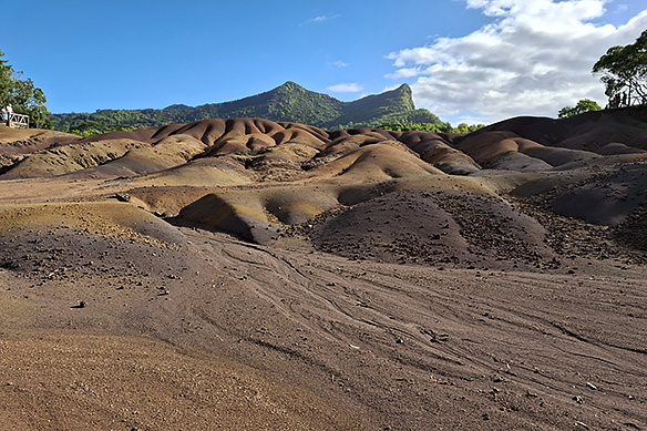
Chamarel 7 Coloured Earth Geopark is believed to be the result of uneven cooling of molten rock. The cream, taupe, peach, and rust coloured sands are rich in iron oxides, while the light pink and lilac coloured sands contain aluminium oxides.
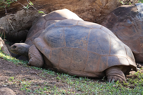
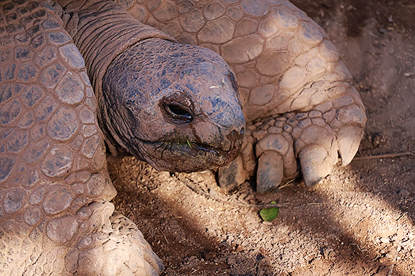
Last Stop: Aldabra tortoises are native to the Aldabra atoll in Seychelles, but can be found on other Seychelles’ islands and Mauritius as well. This lot is in the tortoise pen at the Chamarel 7 Coloured Earth Geopark. A few quirky facts about these giants. They live till 80 to 120 years, lay eggs in 30 cm deep holes which the mother digs out with her huge clawed paws, and they are an endangered species. They are also awfully cute, perpetually hungry, and kind of lazy.
I hope you found this post useful. Wishing you safe and happy travels, always. See you next week in sunny Seychelles!
– – –
Travel tips:
- Staying there: I stayed at the Pereybere Hotel and Spa on Mauritius’ prettiest beach. Added perks were its proximity to a supermarket and money exchange.
- How many days: I stayed for 5 days.
- Getting around: I did a food-cum-walking tour in Port Louis on Day 1 after which I walked around more on my own. For Day 2, I booked a tour. I explored Mauritius island with Akash as my cab driver. He was excellent and can be contacted at +230 5837 6614.
[I travelled solo and independently across Mauritius and Seychelles in August 2026. More islands in the Indian Ocean are in the pipeline. 🙂 ]
Note: There are NO affiliate links in this post, or in any of my posts. Links are provided only to help with your plans or to give extra info. Neither is any of the content in this post or any of my posts sponsored. The services mentioned are what I used and I am simply sharing them with you.


Do you have a scale for the giant clam shell? Also, what are paper trees? Is the bark used as paper .uch like old time use of palm leaves?
LikeLiked by 1 person
Around 12 inches I’d say. And yes, the bark of paper trees has historically been used as paper. Have you been to Mauritius? It is lovely.
LikeLike
Now I understand its use as a basin! Btw, your photos of the thali before and after had me cracking up!
No, I’ve never been to the Mauritius. A confirmed landlubber, I have little interest in beaches. But if old history pulls the strings I’m apt to surrender.
LikeLiked by 1 person
Hehe. The food was delicious and I was very hungry. 😃 I think even the waitress was amused by my wiped clean plate! Nope, there’s no 1300 BCE history, but yes, these islands have lots of slave trade and indentured labour history that is sad and painful. But the Mauritians, like the Seychellois, have been able to put it behind them and move on with zilch bitterness. 🙂
LikeLiked by 1 person
Collective zero bitterness is really commendable! Oh, and I might be persuaded to settle for 130 BCE.😉
LikeLiked by 1 person
What a great place! I’d no idea there was such a mix of races.
LikeLiked by 1 person
And everyone living happily together, despite their painful complicated past. There is much for today’s world to learn from them. 🙂
LikeLiked by 2 people
A lesson indeed.
LikeLiked by 1 person
I think I’ve been intrigued by Mauritius since I read about how it is one of the most well-run African countries. (I know technically it’s not in the African continent, but it’s often included in the group.) Nice to see its many corners through your photos.
LikeLiked by 1 person
Thank you, Bama. This was my second trip to Mauritius. My first trip was very many years ago on work. It has changed/ modernized considerably over the last decade, but still retains a strong island feel — multicultural, scenic, chilled out. 🙂
LikeLiked by 1 person
Pingback: part 2: island-hopping in the indian ocean: seychelles | rama toshi arya's blog